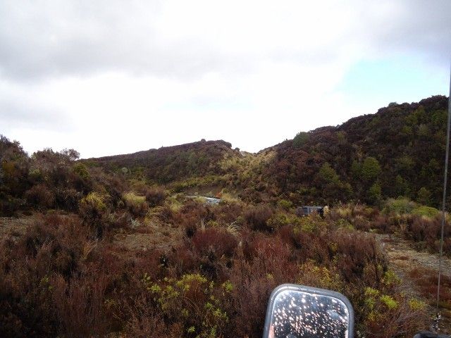
We were trying to follow the old haul road that had been bulldozed from the river where the gravel was mined, through to where it was processed, and finally onto the area it was used in constructing.
Back in the day, little thought was given to environmental concerns, if you needed a road, you made a road. If you needed rock, you went and mined the nearest source. If you needed a flat area to process and stock pile, you cleared the trees and bulldozed the area flat.
As a result, the scars left on the landscape are still clearly visible 30 years later.
The area were the rock was sourced down at the river was obvious, with a well graded two lane haul road winding its way out of the river up onto the flats. That was the end of the haul road we knew about. We wanted to find the other 20 odd K's of it.
Some serious effort was put into maps and calculations over the last few weeks and we located the start of the opposite end of the road, and that was our start point.
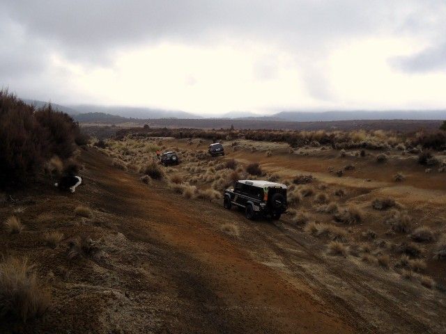
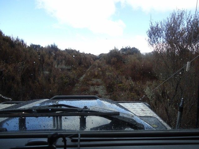
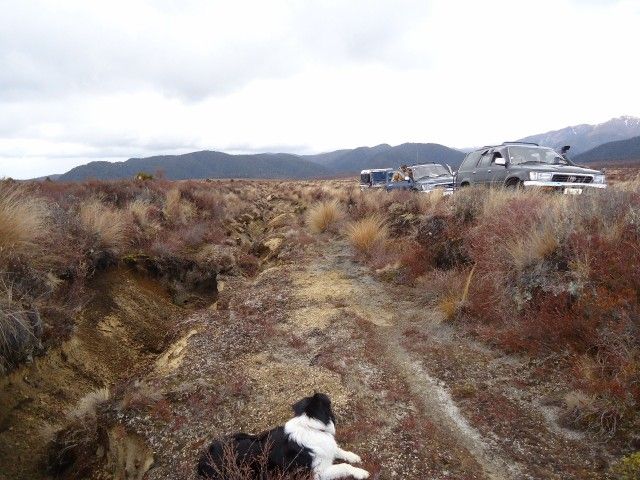
Straight away we knew we were onto the trail, the bed of the massive dual lane haul road was obvious even when covered in scrub.
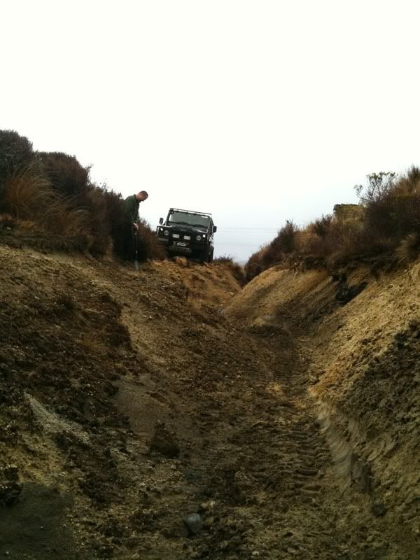
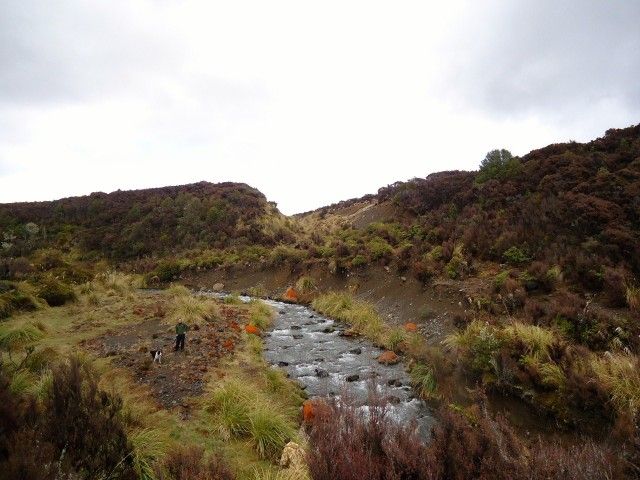
Following this was straight forward until the first river crossing, which would once have been a nice wide ford with a well graded access on either side.
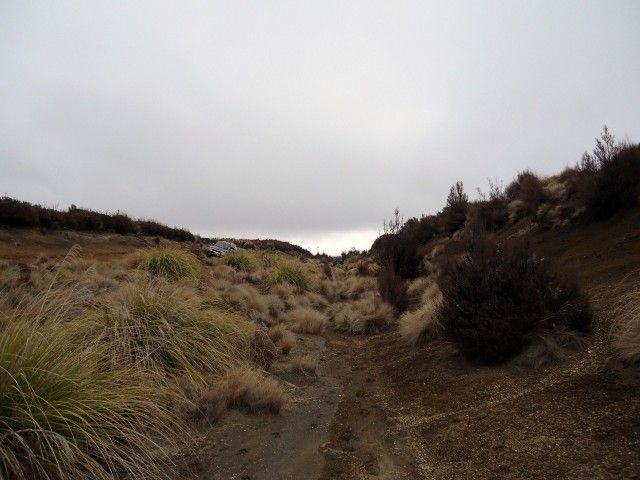
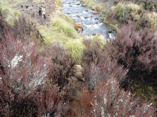
The access on our side was pretty much gone:
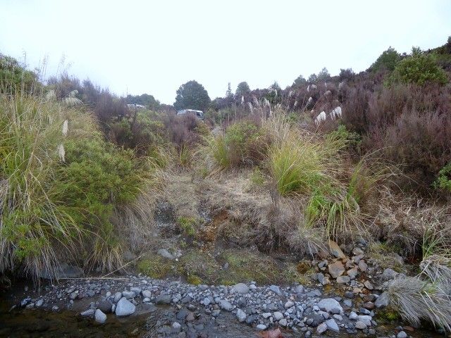
The track was just visible on the other side in the dead center of the pic but, obviously not used due to the washed out crossing. The river looked bouldery but very crossable:
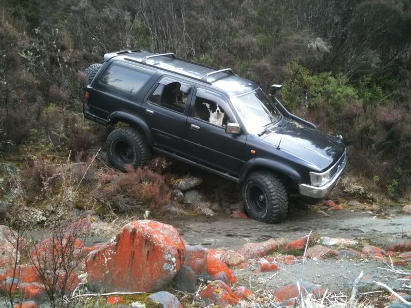
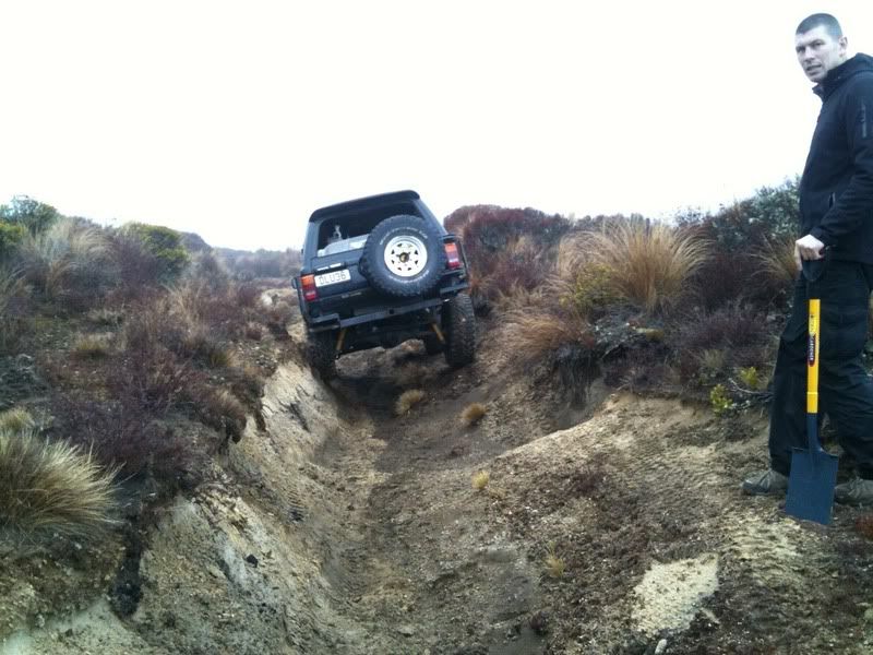
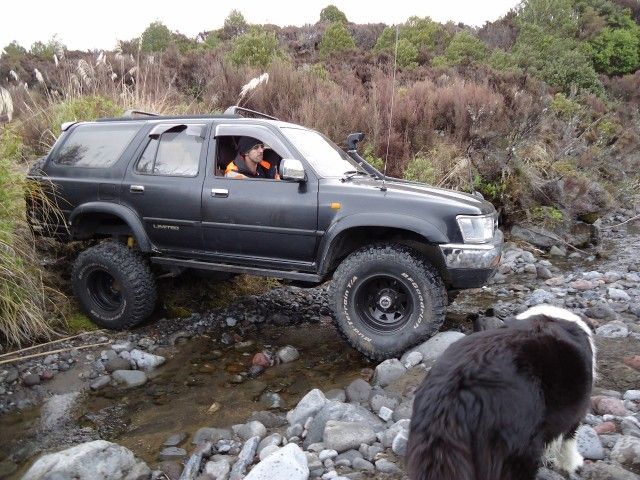
So what to do?? Cross the bloody thing and continue of course!!!! Looking at the barely visible track on the opposite bank, the other side will be where it gets exciting!!!! I got busy guiding the "guinea pig" through the river so the only pic I got was UBZ dropping into the river bed
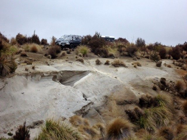
On the other side we found the processing area. Acres in size. Cleared flat. The Scrub was starting to get quite dense, so it was slow going with no defined track and a spotter walking infront of the lead truck looking for hidden obstacles. I don't have any pic's, was well busy behind the wheel, watching the GPS and on foot doing reconessence!!!
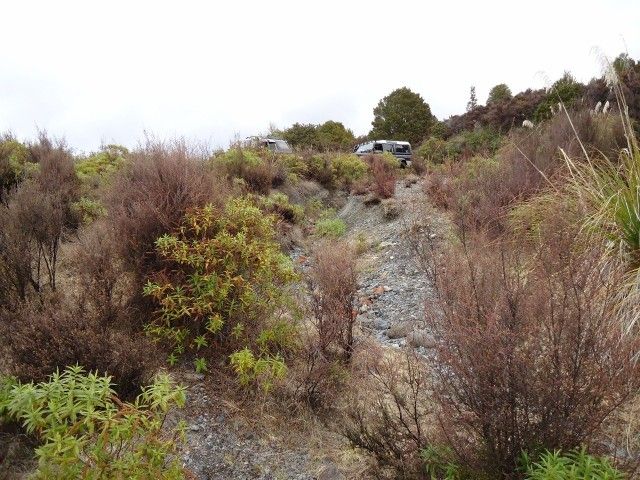
We knew we were on the money when we found this massive cutting that had been pushed through from the processing area down to the next river over.
Looking back up the cutting you can see how wide it would have been. Also quite a gentle gradient for the big trucks hauling heavy loads of gravel from the river for processing. Was cool to see the tussock getting well established!!!
You can see how soft the material the cutting wast put through is, and as a result the erosion is significant.:
If you really had nothing better to do, you could make it driveable without to much work, but once you get to the river, then what??
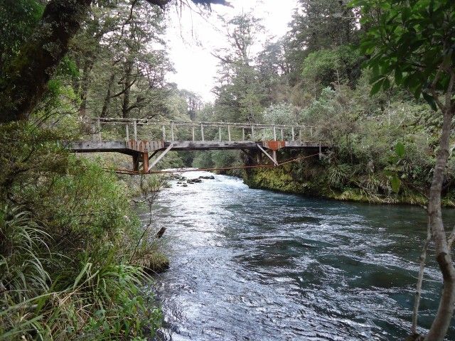
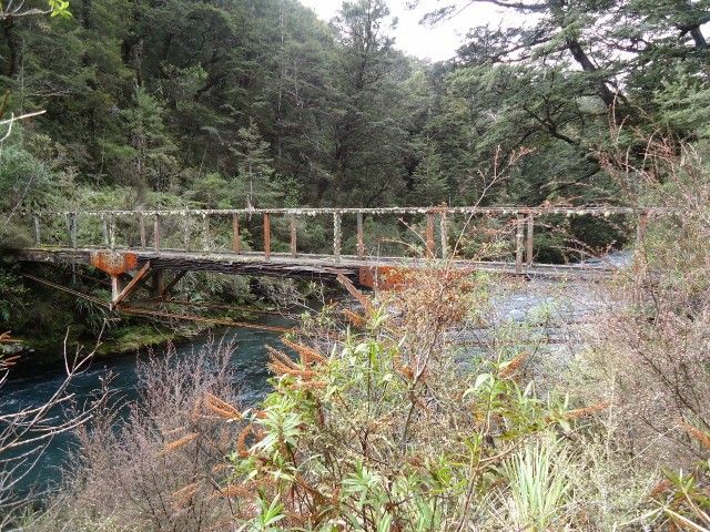
We had found the other end of the cutting on the opposite bank of the river previously, as well as the remains of the missing bridge over the river. We headed back out the way we had come and decided to go back round to the opposite side of the river to the big cutting. That in itself is a reasonable drive round on the main roads, then knowing where to go once you get off the beaten track!!!
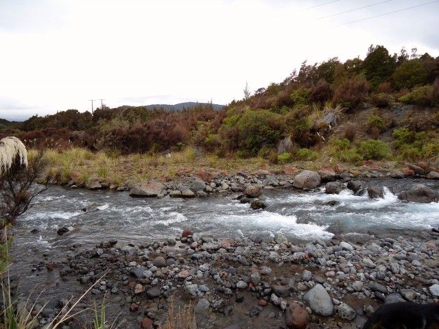
This is the crossing we had done earlier, but approaching it from the other direction on the way out. The track is dead opposite on the far bank. Can't you tell??
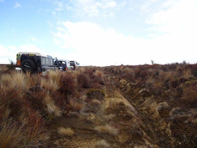
Here we are approaching the massive cutting pictured earlier, but from the other side of the river on the haul road:
The scar from the cutting is like a big notch cut out of the ridge. The old road is to the left, the river has probably change course a fair bit over the last 30 years too. Getting down to the river from the other side would be hard but possible:
Getting down to the river from the side we were on is a job for explosives or a digger, and probably wouldn't last the next storm. Its a big drop!!!!
Either way, the goal was achieved except for a tiny gap in my GPS plot where we didn't cross the river. We had followed the old haul road through the sticks from one end to the other. It really was a great way to keep massive earth works hidden from everyone, even when it was all in full swing I doubt there would have been any visible indication it was all going on in the back ground!!!!!
Next up, we decided to follow an old construction road back out to the main road. The road would have been used for transporting materials in to begin constructing the bridge so machinery could be used in the haul road construction.
Another fine example of what you can do in a D8 Bulldozer when no one cares!!!!
I say they used a bulldozer as there is no attempt to control water flow, and its in one great big straight line as far as the eye can see
A few hours later we were back out on tar seal, and one of our crew left for home. This is always about the time we find the cool stuff
We weren't disappointed this time either!!!!!
We followed a line on the map which used to cross a river and wind its way back out to meet the main road. Once long ago anyway. Where knew the crossing wouldn't be there, but once we came to the edge of the cliff above the river, we found the remains of a walking track complete with a guide wire partially burried under the scrub and the remains of some steps.
Of course we were up for a scramble!!!!
We started picking our way down the cliff towards the river, where there was a good sized terrace above it.
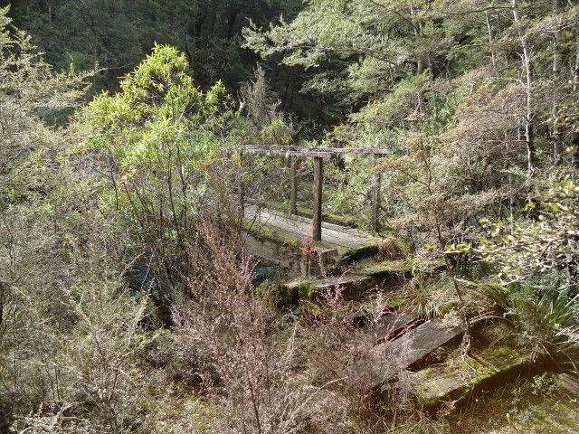
It wasn't long before we noticed this little gem (zoomed in on camera)!!!
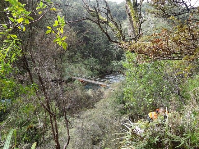
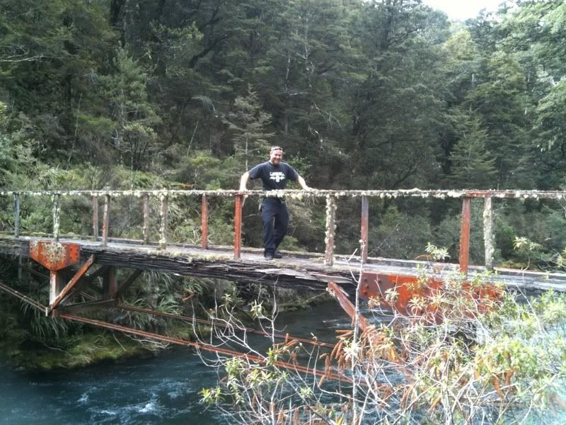
A few meters further accross and down, it was clear it was an old foot bridge
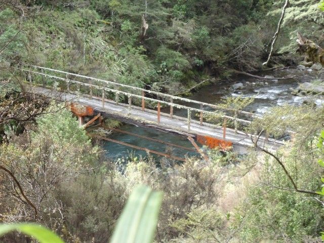
Once we got down the cliff onto the terrace it was clear that it wasn't in regular use
Steps onto the bridge:
Looking accross:
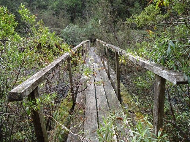
A quick look under the bridge from both sides showed it was pretty well buggered, rotten structural timbers being the least of its issues
Naturally, we had to risk creeping across it one at a time as it wobbled around under us. Horrible feeling, especially when even the railings are rotten and wobbly!!!
We found the vehicle track on the other side, so figure there must have been a decent suspension bridge across the river at that point to provide for vehicular access. No evidence of the bridge remained, so it got us wondering.
We restled our way back up the cliff to the trucks and went round and found the other end of the track and drove to within 100m or so of where we had walked to from the other side.
Good trip, found some cool places. So much to see and do
Tread Lightly