
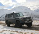
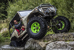
Waimakariri River users
A reminder that two very good areas to use are:-
North bank:-
Harrs Road which runs off South Eyre Road by the Eyre River diversion.
South Bank:-
Weedons Ross Road up stream to Intake road
Both these areas offer good 4WD fun and also trips. I have mentioned before there is a bit too much pressure on the McLean’s Island area so try these as an alternative.
Paul
Waimakariri River 4WD areas
There was quite a long thread on the Waimakariri recently.
The first post on this thread was posted by me back in March. I think it sums up what is happening in the Waimakariri.
Progress is being made on this with E-can and the final result will be a better result for those who use the Waimakariri.
There is a River Management Plan operating and the Waimakariri will be managed in a fair way so that all citizens of Christchurch and Greater Canterbury will have a great asset in the end. 4WD people have been well represented by members of Combined 4WD clubs, and many, many hours have been put in by many people attending meetings and the like so that everyone gets a fair go.
Overall we must remember one thing, river management is all about protecting public and private assets from floods, and that is a key role of E-Can, and recreational use is a small secondary consideration in the overall scheme of river management. For those who are just looking for a play ground to play with your 4WD toys will find that areas will be set up to do that, but in the main recreational use favours people who want a time out area, close to the main population centre of Christchurch & North Canterbury, hence other less passive forms of recreation will take priority close to the city for activities such as dog walking, mountain biking, walking, horse riding and water activities and so on, with motorised vehicle activity set further away so that there is better control on public safety, and fire danger, and also the area needs to be such that the motorised activity will create a low impact on the river eco system and environments. Also a major concern is vehicles coming in contact with people on foot, and push bikes, so there needs to be a split so that people, do not get hurt so designated areas use is a key part of the plan.
So for us it is a managed balance.
Paul
Thanks Paul, Maintaining 4wd access is a full time job, I know ORE is not joining combined now but perhaps we can work together to help secure suitable access. are there any work parties or working bees that are planned, what about public meetings?
I'm sure there will be a number of ORE volunteers keen to assist with thos The biggest thing I have found when dealing with councils is to make them understand that we aren't a bunch of irresponsible hoons and they don't sit in their offices all day. Hopefully a happy compromise will be reached. If you approach them right then things will move. if you approach them the wrong way then they may say no sod off and close access fully.
I'm sure there will be a number of ORE volunteers keen to assist with thos The biggest thing I have found when dealing with councils is to make them understand that we aren't a bunch of irresponsible hoons and they don't sit in their offices all day. Hopefully a happy compromise will be reached. If you approach them right then things will move. if you approach them the wrong way then they may say no sod off and close access fully.
70 series prado (KZJ78) and 90 Series Prado (KZJ95)

Paul
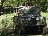
As you are no no doubt aware of how ECAN are now going to block access to the north side of the waimak from the old bride upstream of the jetboat ramp.
How is this helping the 4wd community or infact any of the river users.
All this will do is make the locals who life near the other access point even more against users of the river.
There is no valid reason for this to be done.
I await your comment
Cheers
Trev
Re: Waimakariri River 4WD areas
access4WD wrote:Waimakariri River users
A reminder that two very good areas to use are:-
South Bank:-
Weedons Ross Road up stream to Intake road
Both these areas offer good 4WD fun and also trips.
I have mentioned before there is a bit too much pressure on the McLean’s Island area so try these as an alternative.
Paul
Have you even been in this area before ?????
The last time I was there did not get out of 2wd and saw a Honda City doing donuts having the most fun he even managed to skip accross the inlet race.
Before you start telling us what areas are good to go 4wding in go and drive them yourself. Im sure your mini would be challanged on Grade 1 track
Its NOT a whale !!!!!!!!!!!!!!!! more like a large seal
(021) 02388443
(021) 02388443
-
Sadam_Husain
- Angry bird
- Posts: 5164
- Joined: Mon Feb 20, 2006 12:00 pm
- Location: WELLINGTON

Back off PR  he was only bringing people up to speed. I actually agree with the management plan it MAKES GOOD SENSE :cheers: . If you want to play around, then offer to help turn the park into a proper 4wd park. Actons like these would only help give the community a positive perception of drivers of 4wds that others don't by their hooning under the bridge in full view of the public. If you want to hoon come on one of my grade 5 trips on the coast, try out the winch challenge tracks
Al
Al
rain, hail, sleet or snow, we go!
needswork wrote:Tallsam66 And Pr
You thick nuts!!!
Why attack the messenger?
Dip sticks!!!
Wake up!!!
Paul said:-
"So for us it is a managed balance."
As Benny Hill always said
"Why do you not listen!!!"
There is no need for insults..id insult back..buts its not fair to have a battle of witts with an unarmed opponent.
I just asked question..there was no mailce intended...
I cant see any benefit to any users of the area by having a locked gate & making people drive miles further then drive past local residents houses annoying them...Maybe there was some logic to it..but i cant see any.
-
hosehustler
- Hard Yaka
- Posts: 2051
- Joined: Thu Jan 06, 2005 12:00 pm
- Location: Brooklnands
I have a little "inside knowledge" on the subject I can share, you will be allowed on the North side from the motorbike track west, the only closed area on the north side will be between the jet boat ramp and the motorbike track.
Entry at this stage will be from Heywards rd/Beynons rd, but the locals are very upset about this and I believe a meeting has been arranged, so things may change.
I guess the key note is that the nth side will still be available from the bike track west
Entry at this stage will be from Heywards rd/Beynons rd, but the locals are very upset about this and I believe a meeting has been arranged, so things may change.
I guess the key note is that the nth side will still be available from the bike track west
I hate signatures


-
rangimotors
- Hard Yaka
- Posts: 1631
- Joined: Thu May 10, 2007 12:00 pm
- Location: chch
-
truck-fixer

- Hard Yaka
- Posts: 194
- Joined: Thu May 10, 2007 12:00 pm
- Location: Waikuku
albundy wrote: If you want to hoon come on one of my grade 5 trips on the coast, try out the winch challenge tracks
Al
Whens the next one!?!?!?!?!
My truck might (err ok will) struggle a bit but i dont mind getting pulled outta stuff that it / i cant handle!
Oh and as a bonus i have a electric chilly bin in the back for the beers - gotta keep em cold
This news release has just gone out to all member Clubs of Combined.
I am pleased to also update forum uses accordingly:-
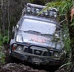
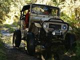
Public 4WD area on the Waimakariri River Park.
A special area has been dedicated for 4WD use in the Waimakariri River park. It is on the north bank of the Waimakariri River
Entry is:- Diversion Road Map grid reference E2471300 N5752513
Enter along stop bank that runs off Diversion Road, then at the end of the bank, turn Right and the area is all that from there down to the double set of Power lines at Grid E2469550 N5752173
Rule No1 Stop Banks:- To access the area, use stop banks, but when on stop banks, drive only on the top of stop banks and use existing tracks off stop banks. Do not drive on grassed slopes of any stop bank, and do not use stop banks for any recreation activity other than passage in and passage out.
Rule No 2 Go for it! There is plenty of existing tracks mud holes and lots of places to explore please do not damage pine trees in the plantation area but you are welcome to drive anywhere basically in the area described above.
Rule No 3 Rubbish:- Take out all rubbish with you and display good habits to the vast unwashed public who may wish to use this area as a dump. Also please do not leave any unattended vehicle behind,
It is our area for all public to use, lets take ownership, set a good example and have good fun!
E-Can will be working with Combined 4WD Clubs on issues, improvements and the like.
Paul
I am pleased to also update forum uses accordingly:-
Public 4WD area on the Waimakariri River Park.
A special area has been dedicated for 4WD use in the Waimakariri River park. It is on the north bank of the Waimakariri River
Entry is:- Diversion Road Map grid reference E2471300 N5752513
Enter along stop bank that runs off Diversion Road, then at the end of the bank, turn Right and the area is all that from there down to the double set of Power lines at Grid E2469550 N5752173
Rule No1 Stop Banks:- To access the area, use stop banks, but when on stop banks, drive only on the top of stop banks and use existing tracks off stop banks. Do not drive on grassed slopes of any stop bank, and do not use stop banks for any recreation activity other than passage in and passage out.
Rule No 2 Go for it! There is plenty of existing tracks mud holes and lots of places to explore please do not damage pine trees in the plantation area but you are welcome to drive anywhere basically in the area described above.
Rule No 3 Rubbish:- Take out all rubbish with you and display good habits to the vast unwashed public who may wish to use this area as a dump. Also please do not leave any unattended vehicle behind,
It is our area for all public to use, lets take ownership, set a good example and have good fun!
E-Can will be working with Combined 4WD Clubs on issues, improvements and the like.
Paul
Whilst ORE is not part of Combined 4WD Clubs Inc, Key executive members of ORE 4x4Assn are members in their own personal way members of our member clubs, thus there is input and communications.
Where we believe wider consultation beyond our member Clubs is needed we promote that.
A good example is the meeting we have arranged where by DOC West Coast officials are prepared to come to Christchurch and set up a meeting with all 4WD interests to outline the forthcoming CMS.
Paul
Where we believe wider consultation beyond our member Clubs is needed we promote that.
A good example is the meeting we have arranged where by DOC West Coast officials are prepared to come to Christchurch and set up a meeting with all 4WD interests to outline the forthcoming CMS.
Paul

SMOKEY wrote:Pete, on my maps ( sorry I don't know how to post map on here ), Diversion Rd is the road that is shown as Harris rd that runs down the LH side of the diversion race. And do they mean up stream to the double power lines ?.
DON'T KNOW IF I'M UP OR DOWN
FITZY.
I assumed it is just that short section to those double power lines too (2km stretch), but am a little unsure just which rd is Diversion rd tho.
Ok people, move along. Nothing to see here. Thank you, move along.
Ph 0212078472
Ph 0212078472